Cyclone Dana: Odisha braces for impact, around 10 lakh to be evacuated
The storm, formed over the east-central Bay of Bengal, is set to bring heavy rainfall in several southern West Bengal districts, says IMD

As Cyclone Dana barrels toward the Odisha coast, threatening to impact nearly half of the state's population, the government is racing against time to execute a massive evacuation plan aimed at relocating about 10 lakh people in several coastal districts to safety.
The India Meteorological Department (IMD) said that cyclone Dana is likely to make landfall between Bhitarkanika National Park and Dhamra port early on Friday. The distance between Dhamara in Bhadrak district and Bhitarkanika National Park in Kendrapara district is around 70 km.
It said that the landfall process will start from the night of October 24 and will continue till the morning of 25 October. The maximum speed during the landfall process is likely to be around 120 kmph, IMD D.G. Mrutyunjay Mohapatra said.
He said landfall is mostly a slow process which usually takes around 5-6 hours. "Therefore, heavy rainfall, wind and storm surge will reach the peak during the landfall time which is between 24 October night and 25 October morning," he added.
Chief minister Mohan Charan Majhi, who reviewed the state government's preparedness, however, said that only 30 per cent of the people, or around 3-4 lakh people living in the identified 'danger zone', have been evacuated by Wednesday evening.
"The remaining people will be brought to safety by 11 am on Thursday," he said.
While asserting that the state is fully prepared to face the calamity, Majhi assured the people that they are in "safe hands".
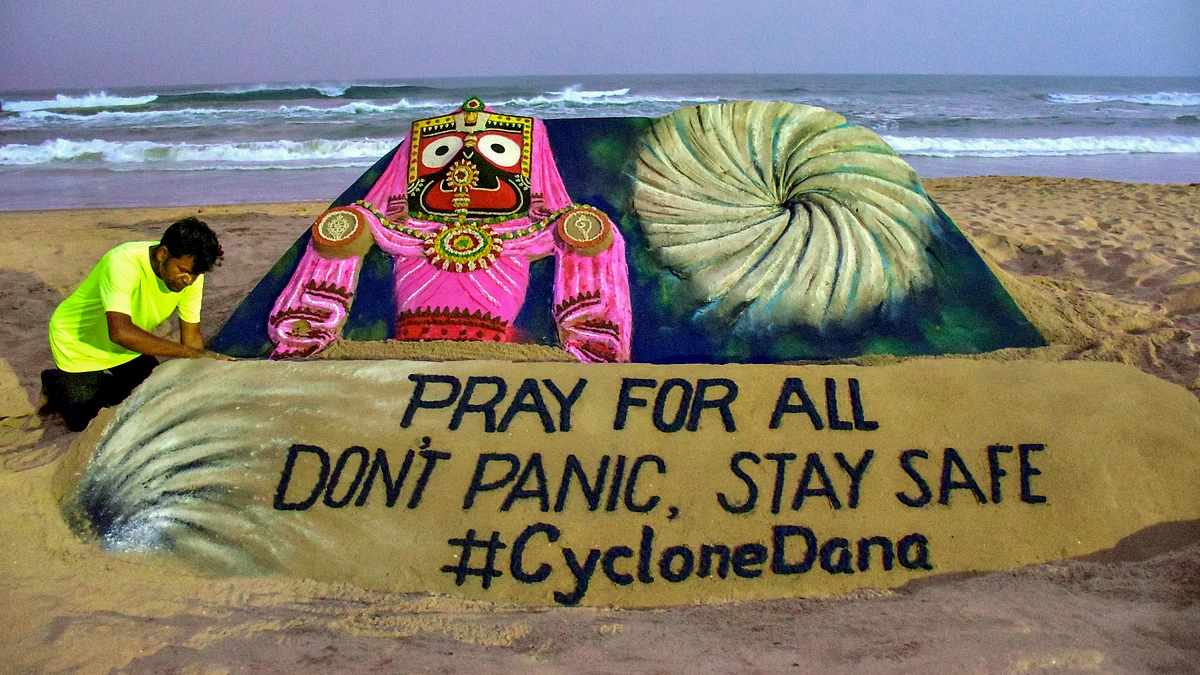
"Do not panic and stay safe. You (people) are in safe hands," he said, adding that all arrangements have been made for the people at the cyclone shelters.
According to the latest IMD bulletin at 9.45 pm, cyclonic storm Dana over Bay of Bengal moved northwestwards with a speed of 12 kmph during the past six hours and lay centred at about 420 km southeast of Paradip (Odisha), 450 km south-southeast of Dhamra (Odisha) and 500 km south-southeast of Sagar Island (West Bengal).
"It is very likely to move northwestwards and intensify into a severe cyclonic storm over central and adjoining northwest Bay of Bengal by early morning of 24 October and cross north Odisha and West Bengal coasts between Puri and Sagar Island close to Bhitarkanika and Dhamara (Odisha) during mid-night of 24 October to morning of 25 October. as a severe cyclonic storm with a wind speed of 100-110 kmph gusting to 120 kmph," the IMD said.
Stating that Odisha is likely to face a multi-hazard situation when cyclone Dana makes landfall, Mohapatra said apart from heavy to very heavy rainfall and in places extremely heavy rainfall and high velocity wind, the state is likely to encounter a tidal surge of up to 2 metres.
IMD scientist Umashankar Das at the Regional Meteorological Centre, Bhubaneswar, warned that low-lying areas in Kendrapara, Bhadrak, and Balasore districts are likely to be inundated and recommended that the government evacuate residents from these regions.
According to IMD sources, wind velocity in the districts of Kendrapara, Bhadrak and Balasore would be 100-110 kmph, gusting to 120 kmph, along with extremely heavy rainfall and tidal surge during the landfall which will take around four to five hours.
The IMD has warned of uprooting of trees, breaking of tree branches, damage to kutcha houses, electric poles and other infrastructures.
Meanwhile, the state government has categorised the vulnerable districts. While Kendrapara, Bhadrak and Balasore are in high-risk zone, where wind velocity would remain at 100-110 kmph, gusting to 120 kmph, Mayurbhanj would be in second category where wind speeds would be at 80-90 kmph, gusting to 100 kmph.
Similarly, the districts of Jagatsinghpur, Cuttack and Jajpur come under category three where wind speeds would be at 60-80 kmph, gusting to 90 kmph.
The districts of Puri, Khurda (comprising Bhubaneswar), Dhenkanal and Keonjhar come under category four where wind speeds will be at 60-70 kmph, gusting to 80 kmph.
To ensure the safety of the people, the state government has deployed 288 rescue teams from the National Disaster Response Force (NDRF), Odisha Disaster Rapid Action Force (ODRAF), and Fire Services.
Districts that are also likely to be impacted include Angul, Nayagarh, Boudh, Ganjam, Deogarh and Sambalpur.
The IMD also cautioned that Cyclone Dana would bring significant rainfall to the state, predicting light to moderate rain at most locations, with heavy rainfall (7-11 cm) in isolated areas over Balasore, Bhadrak, Kendrapara, Jagatsinghpur, Puri, and Khordha starting in the evening of October 23.
On October 24 and 25, heavy to very heavy rainfall is expected in several places, with isolated areas receiving extremely heavy rainfall (over 21 cm) in districts including Balasore, Mayurbhanj, and Jajpur, it added.
The IMD has prohibited all marine activities, including fishing, in the Bay of Bengal until the cyclone has passed. "All fishermen returned to the coast by Tuesday evening," said Pujari.
Meanwhile, parts of Kendrapara and Bhadrak districts in Odisha experienced rain and adverse weather conditions on Wednesday afternoon with the IMD saying that the outer bands of Cyclone Dana has begun to affect the eastern coastline.
With the cyclone approaching fast towards the state's coast, several activities including the functioning of the Orissa High Court, Biju Patnaik International Airport, ports at Paradip and Dhamara, all educational institutions and others remain suspended in wake of the impending calamity.
Meanwhile, the cyclonic storm 'Dana', formed over east-central Bay of Bengal on Wednesday, is set to bring heavy rainfall in several southern West Bengal districts, including Kolkata, the IMD said.
Eastern and South Eastern railways cancelled a large number of trains on 24 and 25 October, in view of the cyclone.
The storm is likely to intensify further into a severe cyclonic storm over northwest Bay of Bengal and make landfall between Bhitarkanika National Park and Dhamra port in Odisha early Friday with wind speeds of up to 120 kmph, the India Meteorological Department (IMD) said.
The cyclone lay 420 km southeast of Paradip, 450 km south-southeast of Dhamara and 500 km south-southeast of Sagar Island at 8.30 am on Wednesday, it said.
The Met warned of heavy to very heavy rainfall with extremely heavy downpours in isolated places in the south Bengal districts of North and South 24-Parganas, Purba and Paschim Medinipur, Jhargram, Kolkata, Howrah and Hooghly districts on 24 and 25 October.
More than 170 express and passenger trains running through South Eastern Railway (SER) jurisdiction have been cancelled in view of the severe cyclonic storm, an official said.
The trains cancelled were scheduled to depart their originating stations between 23 and 27 October, the SER official said, adding that more trains running through the SER zone may be cancelled if the situation demands.
The official said that the last train from Hasnabad and Namkhana stations, which are close to the coastal areas in North and South 24-Parganas districts, will depart towards Sealdah by 7 pm on 24 October.
Ferry services in the Sunderbans area spread over North and South 24-Parganas districts and also across River Hooghly in Kolkata and adjoining areas will remain cancelled in view of the impending inclement weather, officials said.
The Kolkata airport authorities decided to suspend flight operations for 15 hours from 6 pm on Thursday in view of the possible impact of cyclone Dana, an official said.
The step was taken keeping in mind the safety of passengers, airline employees, various equipment, navigational aids and infrastructure, the Airports Authority of India (AAI) official said on Wednesday.
“In view of cyclone Dana's impact on the coastal region of West Bengal, including Kolkata, it has been decided to suspend the flight operations from 6 pm on 24 October to 9 am on 25 October due to predicted heavy winds and heavy to very heavy rainfall at Kolkata,” an AAI spokesperson said.
Follow us on: Facebook, Twitter, Google News, Instagram
Join our official telegram channel (@nationalherald) and stay updated with the latest headlines